-
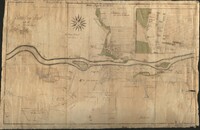 Bethlehem Tract with all the adjacent lands
-
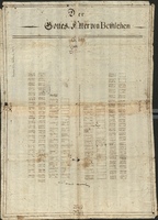 Der Gottes-Akker von Bethlehem
 Plan of God's Acre (cemetery) in Bethlehem, showing graves from 1742 until 1749 (plot No. 125)
-
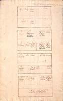
 Plan of the Gemein House
 Floor plans for the Gemeinhaus in Bethlehem, Pennsylvania, with names of the occupants of each room
-
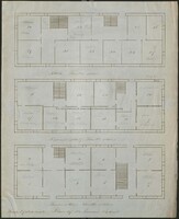
 Floor plan for four of the floors of the Brethren's House with labeled rooms
 Floor plans of the basement, ground floor, second floor, and third floor of the Single Brethren's House in Bethlehem, PA, with indication of room use
-
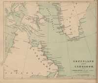 The Moravian Atlas: Map of Greenland and Labrador
 Plate number 5 from The Moravian Atlas digitized by the Bethlehem Digital History Project.
-
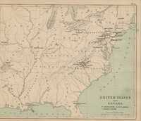 The Moravian Atlas: Map of United States and Canada
 Plate number 4 from The Moravian Atlas digitized by the Bethlehem Digital History Project.
-
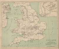 The Moravian Atlas: Map of England and Part of Ireland
 Plate number 3 from The Moravian Atlas digitized by the Bethlehem Digital History Project.
-
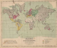
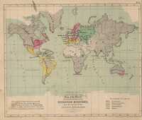 The Moravian Atlas: World map showing the position and extent of the various religions
 Plate number 1 from The Moravian Atlas digitized by the Bethlehem Digital History Project.
-
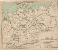 The Moravian Atlas: Map of Germany, Switzerland, and Holland
 Plate number 2 from The Moravian Atlas digitized by the Bethlehem Digital History Project.
-
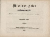 Missions-Atlas der Brüder-Unität
 Maps and statistics relating to the movements and missionary settlements of the renewed Moravian Church worldwide from 1722 to 1860.
-
 The Moravian Atlas
 Maps and statistics relating to the movements and missionary settlements of the renewed Moravian Church worldwide from 1722 to 1852.
